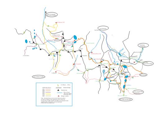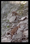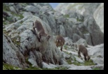
Above ref. Cougourde
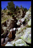
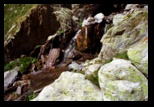
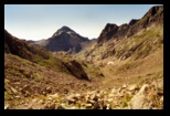
The higher
valley opens
just above this stream

Col de la RUINE
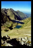
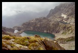
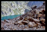
View on Lake Brocan ,
on Italian side
 |
Day 1 : August 27th, - Col de la Ruine (2724m)
I leave Le
Boreon (alt 1526) in the morning, anticipating the long climb to
the "Col de la Ruine".
While in 2003 I followed the hill-side path (marked as a GR), and found
it not particularly interesting, I choose this time to walk up the
one-way road along the Vacheries de Cerise ( at the time, they were
still only planning to establish there an enclosed "wolf park" as a
tourist attraction - I noticed in 2006 it was indeed installed).
This takes to an official looking park entrance, with some
display panels about the fauna.
The climb begins along the well-trodden path, and takes me in
mid-morning to the Refuge de Cougourde (2110m) : a new, massive stone
construction which has replaced the old bright yellow metal building.
It is largely used by climbers attracted there by the impressive face
of the Cougourde.
A coffee at the refuge, and I get some minimal directions to the Col de
la Ruine, which is absolutely not posted (the same is true of the path
from Cougourde to the nearby Lacs Bessons).
There is a possibility to camp close to the refuge, but the area seems
to be daily invaded by cows.
Some hint of path leads upstream , past the water intake
for the refuge, to a small lake, then one has to follow the stream up a
more rocky part , to enter a new, higher valley. The path flattens
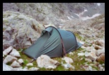
again, there is a perfect site for a bivouac, and I had planned to camp
before the pass, but we are still early in the day, and I just
stop for lunch an a short rest.
A small path branches off to the right to the Agnel (the mountain, not
the lake -- see later-- of the same name, which is in a completely
different place: there are lots of "agnel" places in the Alps -
possibly related to the french word which means "lamb" ) , while
the way to La Ruine seems straight ahead. The path becomes
more difficult to find, I meat a hiker coming from the left (Lac
Bessons), he has a picture in his travel guide showing the "Col
de la Ruine".
I probably try to climb to quickly, leaving the stony bottom of the
small valley, and have later to compensate by moving down a rocky
slope. Finallly, I get to the foot of the last section, in a fairly
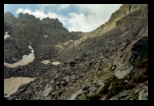
unstable scree (stone field). Some cairns suggest paths, but the pass
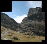
itself is consituted of a fairly naked stone plate on the left ,
and very unstable small rocks on the right (see picture).
After this last stretch, I make it to the pass. On the Italian
side, the remains of a military path (there were fortifications
all around) is much better maintained, but, as I was warned in the
refuge, a sloping snow patch forbids to use it on the first few
meters. One has to dip lower in the stones to avoid the (dangerous)
snow patch. The path is anyway well marked, and combines the old
military
path and short cuts, sometimes atop a morraine, to avoid more snow
patches (neves) on the way down. No water here, I have to walk down
almost to the Lake Brocan below (well, maybe 100 m above still) to find
a nice meadow, and river, where I set camp for the night .
|


pictures form 2006
see 2006 page
|
Day 2 Col de Fenestrelle
A nice night
to rest ( yesterday was a rather long day!),
and an easier trip to look forward to .
I stop a Refugio Genova for coffee and a log in the register.
This year the keeper is very helpful and confirms that there is
(I only suspected it from the maps) a possibility to reach Pagari
without going down all the way to the valley. (see day 3)
The path to Col de Fenestrelle is easy (but little water
available under way), mostly a mule path, with this year still a small
(easily crossed or avoided) snow patch 50 m below the col.
Looking back, I don't seem to have taken pictures, but some can be
found in the
(I include them here for reference) . The scenery is much softer
and greener on the other side, but in the distance the bulk of
the Gelas massif (this is for tomorrow ) is quite impressive.
I stop briefly at the Refuge Soria Ellena (where even asian meals are
available!), and try to gain some height in preparation of tomorrow's
trip (for which I also recieve more detailed info, notably about the
possibility to cross a sloping neve - or glacier remains with the
help of a steel cable, which is in place). A group of French
hikers is also planning to take the same path, and they comment about
safety equipment. I leave the refuge along the wide path which
leads to the french side (Madonne de Fenestre), and take left at the
branch point, after some ascent, the path comes close to the
river providing the water for the refuge, and I find a (sloping) tent
spot close to a waterfall. (note : there is a short cut from the
refuge, see 2006 page)
|
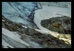
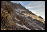
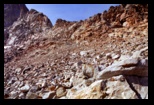
part of scree, from
below,
the correct par follows the
ridge
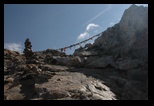
more pictures of
the col
are found in
the 2006 page,
this
includes the
following, given here
for illustration :
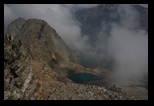
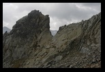
(the 3 pictures above
were taken
in 2006)
|
Day 3
: Along
the Gelas to Pagari
I
start around 7 on the path, and follow the river until it meets again
the mule path, and keep going. In 2004, the markings (once leaving the
mule path) are mostly by cairns (in 2006, I noticed fresh red paint
spots). After the first stretch, which is almost along the gradient,
the itinerary veers to the left, and the ascent rate decreases. At that
moment, I hear repeated knocking noises reverberating from the stony
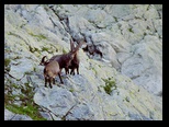
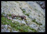
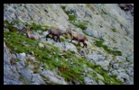
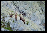
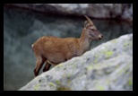
walls around. A group of male Ibex are measuring up. They perch on some
rocky formation, and in turns proceed to various intimidation signs
(rearing up, ...) trying to force the opponent to back up (which
implies turning back, as they are on some wide ledge). It seems more
like sparring or measuring up than real fight. Other male Ibex around,
some apparently older stay unmoved, of after a while amble by and push
them aside...This year I only have my 180mm lens along, atop an
argentic slr. (in later years, when coming to the area, I add at least
a doubler), but I include a few of the pictures below.
Well, this
encounter took me quite some time (about an hour watching and picture
taking, unfortunately the location did not allow me to get really much
closer), and there is still a long way.
The itinerary keeps climbing as it moves west to the pass (not yet
visible). Sometimes the line of cairns get lost (in 2006, the colour
marks were never missing, and it paid to look for them), but I get to a
couple of passages on snow (reasonably flat, and only a few meters),
before meeting the strong steel cable which crosses over the remains
of the lower part of the glacier (you could call it a neve, as it
is not permanent each year, and seems to be more snow than ice). In
case of snow, the cable
(or some serious ice equipment) is much needed, as the stretch to
cross, if narrow (less than 10 meters) , is icy and very steep. I
had hoped to encounter the french hikers on the way, but later learned
that they had opted for the longer but tamer route going down to the
valley...
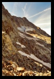
There are more pictures in the 2006 page, but I show here the distant
glacier and the left over snow patches.
It is then an easy matter to reach the col. There, another steel cable
is stretched from right to left.
Here (I later learned) I got confused about the instruction (or did
someone down there have a laterality problem??), and opted to continue
through the right side of the pass. (the correct and safe way is to
take on the left, that is why the cable is there, in case of snow! -
one then gets a narrow bu safe crest to walk down to the bivouac
below). The descent I chose starts with about 10 meters along a rocky
but easy face (plenty of grips, but hands absolutely needed), but then
continues along a long and unfortunately VERY unstable scree. The size
of the rocks varies, but stability is never good, and at times,
traversing is risky... After a tense few minutes, I got at the foot of
this, but too far to the west to reach the bivouac and the path below.
A large tabular rock seemed a good place to rest, but it rolled under
me, and I took a while to get up, -- with just a bruised forearm (I
strongly advise the other path, which is now unmistakeably marked in
red, and leads quickly to the "bivouac", that is a small emergency
refuge well equiped in beds, and meant for climbers to the Gelas
(called Maledia in Italy). Better pictures are found in the 2006 page.
From here, the path is again obvious, and goes down more scree, this
time very large stones, along a an obvious path, before reaching a
couple of lakes. I am now in a hurry, and don't stop for more
pictures, as I am worried that my fall may have caused more damage than
I feel (fortunately, it does not hamper progression), and the sky is
covering fast. A beautiful day now turn the heavy skies, and there is
still quite some way to go, even if it is on a fairly good path this
time. The itinerary dips further, to avoid a rocky face, and continues
west before ascending again. The ascent is through another scree,
through some sort of pass, and meets the valley below Pagari. At this
time there is some water flowing. (in 2006, basically all the water was
alimenting the refuge later in September).
Not clear I would trust the quality of the water below the refuge (as a
matter of fact, a notice on the same stream, 1000m below near the
bottom of the valley on the path from Entracque voices some similar
concern ). I follow the river up, and reach the refuge by the "back
door", as the first drops of rain are falling. There is no real
alternative to using the refuge, as there is little possibility to put
a tent. Good occasion to meet the french hikers again, to compare maps
(we never found two maps with similar paths indicated, and I doubt any
single map has all the paths), to eat some delicious vegetarian food
prepared by the landlord, and to receive further advice on forthcoming
itineraries. The Landlord
(who has travelled extensively in Thibet, and answers to the name of
Alladar) is a
legend by
himself (as of 2006, he actually published a book - only available in
Italian) containing the history of the refuge, and describing the
itineraries around it. As the refuge can be reached by phone, it may be
a good idea to contact him in advance for reservations, and advice.
|
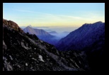

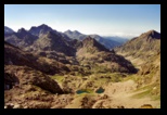
fFrom col de Pagari to
French side
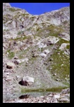
Pagari seen from the
lakes below

A perfect place for
bivouac
... for another year!
|
Day 4
: Pagari to Basto
The next day, the storm has blown away, and a clear, crisp
sky give contrasting views of the valleys below and the rocky part
above. It is an easy walk, among large stones, to "Col de Pagari", from
where a well-established path (strangely absent on some French maps)
leads down first to twin lakes, then to Refuge de Nice.
It would be a perfect place to bivouac, but it is still early in the
morning, and I proceed with regret to the Refuge de Nice. From there,
as the weather becomes cloudy again, I prefer to take the well-trodden
path to Col de Basto (part of the GR). (this is also quite a scenic
walk, anyway, as I know from 2003)
At this time of the year, I only meet a few people. I decide to bivouac
at Lac Niré, where I can also find some flowing water.
|
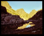
Bivouac on the way to
Basto,
as seen at sunrise
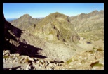
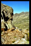
From Basto, looking East
|
Day 5 : Baisse du Basto to Lac de la
Lusière
The morning is crisp again, and I can walk in cool weather
up to the Basto, the latter part of the path being a rather steep (but
on a reliable path) stretch up to the col. The col - called "baisse" is
very sharp (the kind where you can put a leg on each side of the
mountain) and the view on both sides is striking.
I reach then quickly the path crossing just below the Baisse de
Valmasque, after another descent in large-blocs scree (still part of
the GR, - I even came across a team repainting the tell-tale marks!).
This is an area I know very much from other trips (and a true
crossing-roads for those taking short trips around Vallée des
Merveilles, Fontanalbe and Valmasque). It is also a popular bivouac
place, as it offers wide grassy areas, running water, ... just outside
the no-camping areas.
Also, I always met some form of wildlife here : marmots, Ibex, Chamois,
Hermines...
But for today, it is really too early to think of rest, and I hesitate
a bit. I remember Alladar mentioned the Lac de la Lusière as
offering a tiny tent spot. It is not far, but definitely outside of the
beaten path, ... just what I want now. It takes walking down the
Valmasque valley (a boulevard, ... and often just as crowded with noisy
day-trippers : no wonder they see little wildlife!), until a perfectly
clear path ascending the left wall of the valley is spotted (after
crossing on top of an artificial dam). Another path often missing from
maps! The path narrow and gets a bit steeper as it meets the stony
banks of the Lac de la Lusière, well-hidden in a circus of the
mountain. (this is also a convenient way to ascent to the Pas de la
Fous, see 2006 pages)
 |
The descent on the West side,
The "Baisse de Valmasque" (flat, gray, at the centre of the picture, to
the right of the central mountain), leads to Vallée des
Merveilles.
"The Baisse de Fontanalbe" is on the other side of the central mountain. |
|
Lac de la
Lusière (above) and lacs Gelés, from "baisse de
Chamassière"
Lac de l'Agnel, from
"baisse de Chamassière"
Baisse de
Chamassière,
looking back from Lac de l'Agnel.
|
Day 6: Lac de la Lusière to
Casterino
This is a slightly misty morning (not surprising, so close
to the lake). A troup of female Ibex, with their young is playing in
the rocks. This involves some pretty vertical attitudes!
Going around the lake, a line of cairns leads (without loosing height,
and after a short climb) to the Baisse de Chamassière, which
opens on the Lacs de l'Agnel side. Here, another wide scree. This year,
I go down (some cairns) to the Lac de l'Agnel, passing on the small
land bridge between the large and much smaller lake. (an alternative is
to follow to the left, nearly at constant level, a better marked line
do cairns which leads to Col du Lac de l'Agnel -- see 2006)
Having reached the level of the lakes, I still have to reach the mouth
of the larger one. As there are some rocks in the way (see picture),
one needs to go a bit higher, on a partly grassy slope, before finding
a path - a bit tricky at times. From the dam, a well-marked and much
used path leads down (no water till the bottom of the valley) to the
lower Valmasque valley, and to the parking lot at the end of the
Casterino road.
Some tired small kids on the way finish off my supply of dried fruit,
for once my pack is almost empty (except for the pack of nuts I keep
for emergencies).
|
|
Day 6+: On the way out...
I walk down to Casterino on the road, and, since it is
still early, hope for a bus to take me to the train line. In summer,
there is such a bus around 4pm. But this is already too late in the
season. Phoning is difficult here: as of 2005 at least, portable phones
don't connect. There is a France Telecom booth, but it uses specific
cards (and the local inns don't stock them, or are just out of them..)
If needed, the Hotel Marie Madeleine (which also has a refuge part)
maintains a coin-operated phone.
I start walking the 15 or so km, with a near-zero hope that some car
will take me for the ride. (my backpack must seem very large !) . I am
lucky: a couple coming back from an old military vehicles event drives
down the road with a WW2 jeep in tow. They offer me to settle in the
latter, and I have a beautiful ride to St Dalmas, where I catch a train
for Tende (I find the rather old "hotel du Centre" very quiet and
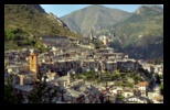
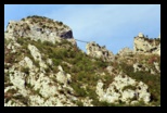
convenient). Just for completeness, here are pictures of Tende, and a
view of the monkey bridge of their Via Ferrata. There are various
possibilities in Tende (more in season), like VTT or via ferrata. The
beautiful open-air swimming pool is unfortunately not accessible (no
guards available at the end of august); if interested in the via
ferrata, it is advisable to check with the tourist board how much of it
is accessible, as a part was in refection at least in 2004 and 2005
|
