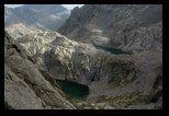
Last lake
on the French
side

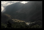
A look on
the French side
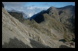
The Italian
side
 |
Day 1 : Sept 8th : Fremamorte
I thus get the exceptional luck of being dropped by car just at my
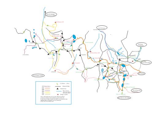
desired starting point: "Col de Salèse" (see the sketch
of paths at
the top of this page), which puts me at 2030 m, within easy
reach
of my target: the "col de Fremamorte" at 2615m, despite the late start.
The path is clearly marked, and climbs through a green area (still some
trees) on this south-facing side before entering the rocky part, which
will become our world for the next week. Quickly also the weather
starts to deteriorate, and the summits to the SW appear against a
backdrop of dark clouds. The pass above however stays
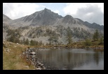
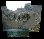
unpredictably clear! A small stop by the last lake on this side of the
mountain, and I get to the final climb in a stony area (which I should
call "scree", but the French language has many different words to
distinguish between the various types, from "farrier's" to
"ghoulish in stables". Here, it is a fair path in small-sized,
stabilised stones: a track pretty suitable for mules for instance.
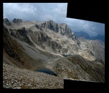
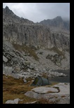
I am in a bit of a hurry to reach the top, but take a quick picture of
both sides, contrasting the relatively green French side with the stony
Italian one. (I heard some people in St Martin call this the
"vallée morte":
there is water and lakes also, but the running water is
mostly
buried under stones). The sky is now getting cloudy, and I
loose
no time to climb down, still through an easy path, to the first of the
lakes. A "bivouac" is mentioned on the map (this is one of the
unattended shelters in the Alpi Marittime park, intended for emergency
use), but I certainly prefer to set up my tent and try to recover some
of the lost sleep of last night.
I get the visit of 2 park rangers -who look actually more like eager
hikers!- who remind me that open fires are forbidden (there was an
obvious fire ring left by previous hikers a few meters from my tent).
We discuss the itinerary for the next days, and they advise me to try
the Brocan pass (which I had contemplated to do) rather than
walk
down to Terme di Valdieri.
|
|

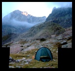
packing
time in the
morning |
Day 2 From
Fremamorte to Remondino
(Argentera)
The morning
is foggy, but
not threatening, and the visibility seems sufficient, specially since
the first part is on the way down, and the path should still be quite
clearly marked.
The path (there are even some sign posts!) goes steeply but comfortably
down to about 1800m to the "Piano della Casa". Mid-way, large
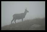
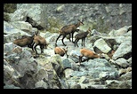
scarfs of fog brush across, and I just make out the outlines of a herd
of chamois. (adults and a number of young). This is a good pretext for
a stop, and some attempt at pictures.
Down in the valley, the path meats another, coming from the Col de
Cerise (or possibly Mercantour). I cut across (at approx 1800m), pass
the Rifugio Regnia Elena to reach the steep uphill path to Remondino.
The first part of the path winds close to a river, but at about
half-way, it goes into more stony ground, and no water is available
until the fountain at the refuge.
There is little possibility of camping until the refuge is reached, but
there, a number of terraces - precisely in the direction of
Col
de Brocan offer an ideal situation.
I set up the tent, and cook for the night, but as a matter of safety,
also visit the refuge for an evening coffee, taking the opportunity to
log my passage in the register (a habit developped in Sweden as a
safety measure) .
Overnight a small noise: a fox is pacing a couple of meters in front of
the tent - maybe it smells the cooking- and is not scared
when I
glance through the door.
The next morning, I use the phone (all the Italian refuges seem to have
one) to inform my wife of my next moves. It is not possible to use
phone cards, but the cost is reasonable (usually between 1 and 2
€ for
a short call). (needless to say, portable phones don't operate in the
park).
|
|
 |
Day 3
: Col de Brocan
Preliminary investigations
told me
that the path to Brocan is relatively easy to find, but that the
descent on the other side is very unstable. I want to
complete
the climbing part while this part of the mountain is still in the
shadow, but at this season 8 am is still early enough (this is a steep,
North slope!). The first climb is steep, in big, stable rocks, and
clearly marked. A first fork (also clearly marked) branches to a path
to small lake.
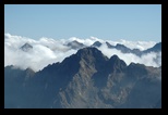
After climbing in the shadow, with a hint of mist at times, one comes
into the full, harsh light around 2800m, and the view is striking (we
are not that much below the top of the chain), and almost violent in
contrats.
The path continues, following almost a level curve among large blocs,
and branches once again: an indication to a path to the right indicates
a connection to Col du Mercantour: definitely a way to
explore in
the future!
Meanwhile, I stay on the path to Col de Brocan, which crosses the
Argentera massif just under the summits, at 2892m according to the map.
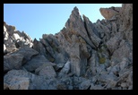
The passage of the col is easy, even it it looks very angular from
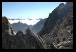
below. I rest a few minutes,contemplating the clouds below, and with a
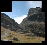
little apprehension for the descent (I took a view on Day 4 showing
this side of the mountain).
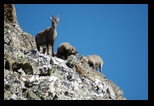
During the rest, 3 Ibex, gently walk down the ridge.
The descent is definitely not comfortable (and I later heard that at
least some guides don't want to use it ), as the scree (a stone field
composed of a mixture of small, and other large, unstabilized
fallen rocks, as the mountain is obviously shedding them) is definitely
unstable. Even big rocks cannot be trusted, as they are ready to slide
on the rubble under. Particularly with a heavy bag, this is trying. A
small horizontal snow field give a few meters of rest... This is a long
descent before one reaches more stable ground, close to a small stream
(at this time, too tenuous to provide a drink).
The marked itinerary finally joins a path I took in 2004 (from Col de
la Ruine - or Rovina ) ,
and instead of turning left to the Refugio Genova, I cut across to the
right, to a green patch along a stream falling from the mountain.
Perfect place for a rest in the sun, to wash in the river and later to
pitch the tent! (I took no pictures, probably will post them when
writing up the 2004 trip) -- an alternate bivouac place would
probably be close to the Brocan lake itself,
as there seems to be little flat opportunities closer to the path.
|
|
|

|
|

 |
Day 4
:Fenestrelle
The morning is not particularly sunny (in fact, the
sky is
clear, but it will be another 2 hours before the sun reaches this part
of the valley), and I am surprised that the condensation that I noticed
yesterday inside the outer part of the tent has completely disappeared.
A sticky, white powder on the bottom of the tent and on the higher
parts of the grass brings the explanation: the frost has condensed the
humidity.
I am on a known path from 2004, and even on an easy one: after the
rifugio Genova, it is part of the GTA (grand traverse of the
Alps).
I stop quickly at Genova, and after the ritual coffee, try to log my
passage in the register: this is in fact full since several weeks, and
it proves impossible!
The ascent to Fenestrelle (2463m) is gentle, but slow, as the path
(obviously a mule path in the past, but damages at places) is winding
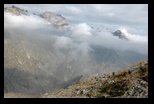
painstakingly up the slope. There is an excellent view of the Argentera
massif, with the lakes at the bottom (the left one is the Brocan lake).
When clicking on the thumbnail, a larger panorama appears (I did not
include the full resolution to speed up the loading), with a red mark
indicating the Col de Brocan.
The other side of the pass is in full contrast, a really gentle, grassy
slope which leads, after a long descent, to the valley and Rifugio
Soria Elena.
The picture however already shows the dark slopes of the Gelas, which
we need to climb tomorrow close to the glacier to reach the Passo del
Ghiacciai (2750m).
When I stop by, it is closed for the day (but a safety bivouac is open
50 meters below); as I was in any way not planning to stay there, I
take the small path from the refuge (it follows the buried water
supply) up to a stream, and walk up to 2070 meters approx., where I
find just enough flat space to put my tent.
It is a bit dark when I set up the tent (the weather gets cloudy
again), and I am a bit careless, for some reason, a few sections of one
of the big "loop" poles of the tent don't properly lock
(they overlap by only 1 cm instead of 4 or so). I hear a succession of
snapping noises, and remove the pole hastily to contemplate the damage:
fortunately it is easy to make a temporary fix (without using the
repair kit, which would in any way cover only one of the damaged
spots), and with proper assembly, the pole looks still solid, even
under tension. I am very surprised that this happened, as I have used
the tent without any incident for 5 years now, and in much more
difficult contidtions (e.g; setting under driving rain). Probably some
dust piled up. I since replaced this pole (see why on day 7), and the
new version is fool-proof: instead of having a tapered and an enlarged
end on the yellow-coloured aluminium tubes, there is now a uniform size
yellow tube with a silver-colored insert, and the locking mecanism is
much more positive... and, due to the colour difference, foolproof!
|
|
Argentera
seen from
Gelas

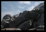

where the
snow should
have beenn
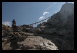
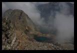
Biv
Moncalieri
from the pass
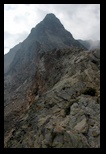
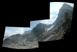
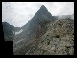
TjeThe ridge to
Moncalieri

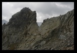
View from
Moncalieri

 |
Day 5 : Along
the Gelas to Pagari
First a question of names: on Italian maps, the
Gelas is
designated as Maledia.
I walked this leg in 2004, and know it can seem long-- and stony, so I
made sure to get some advance by camping quite a bit higher than the
refuge, and by starting early.
Yesterday I had taken a short cut from the refuge, and I keep climbing
along the stream, to join the main (infinitely winging) path. Once
reached, this is very convenient, although a bit slow in climbing rate.
After a while, we get above the Fenestrelle range, and the view of the
Argentera is impressive
(see picture); the low clouds are probably still raining on Entracque.
From a path, we move to a scree, with mainly big rocks, and make sure
to stick to the (very good, freshly made) red marks. I should point out
that this track is vey dependent on weather and snow conditions. It
typically crosses ends of glacier or strong-sloped snow fields
(sometimes with the help of steel cables). In any case, you should
check before hand with local people (in refuges) or with the
well-known Alladar
in Rifugio Pagari before venturing on this trail, unless you
are
fully equipped for snow/glacier conditions.
At some point, a warning sign "solo escursionisti esperti" springs
amongst the rocks; it looks
like a cross, with a stone on top reminiscent of some western comic
strips...This is new, obviously this track was re-marked since 2004.
Actually, the snow is completely absent at this time, and the steel
cables have even been removed. Nevertheless, the passage is not really
easier, as the stone field below the snow is fairly unreliable, and one
has to use the cliff itself. (see picture)
Finally the pass is reached. (the cable is usefull in case a snow field
has lingered here,
some of the cloth strips are related to buddhist prayers, others are
probalby just pranks from hikers - in particular a pair of used socks)
This year, the marking is very clear, and shows one has to cross the
pass and go down
along the ridge to the left of it. This ridge is "airy", but perfectly
safe (see pictures) and leads directly to the Moncalieri bivouac;
In 2004 I had gotten confusing instructions, and tried instead to go
down on the left. This is
perfectly feasible, it starts with a short cliff with solid rock edges
(providing good finger grips, but rather vertical). However the real
difficulty comes later, as one lands in a completely unstable scree.
(flat, unstabilized stones which yield under the foot, and threaten a
small
avalanche): definitely NOT recommended!
From there, it is a short (but careful) path to the Moncalieri
Bivouac. From outside, it looks completely artificial, with
its
metal cladding, but inside it is a pretty cosy place, perfect for a
short rest or an overnight stay (several comfortable berths, a table,
some candles, a register to log your passage). However, there is no
water in immediate proximity. In principle there is a small stream
about 50m below, but at this time of the year, you just hear the water
flowing deep below the rocks.
The next step is to go down, through a fairly stable scree and a
well-marked path to the lakes below. This path is really the occsasion
to decide whether you like stones or not. I picture a few below, just
to give the impression, together with a chysanthemium (looks like a
purple daisy). A few Ibex wander around in the stones.
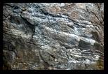 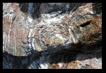 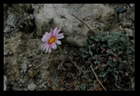 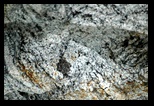 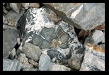 
Well,
from there it is still a way down, first reaching the lakes, then still
going down before one can climb again, after avoiding several rocky
formations, to Rifugio Pagari.
Once reaching the Pagari valley (in particular the stream which should
be flowing!), I realize two things:
- there is essentially NO water flowing (or then, it flows
once
again below the rocks)
- as in 2004, it begins to rain -- gently at first, with wide-spaced
heavy and lazy drops.
Impossible to camp at the entrance of the valley in those conditions,
and I proceed to the refugio.
Once there, it is quite impossible to set a tent: whatever available
space is taken by a botanical garden, and, furthermore, Pagari is a
legendary place (its keeper, even more so), so why miss the
opportunity? To further convince me, the rain has now turned to hail,
slow at first, but increasingly convincing. I must be tired, because I
feel cold in the refuge (the temperature inside is a full 14°),
but
I enjoy some tea, log my passage, and settle in one of the dorms.
Another guest is announced, he will settle in the other dorm: complete
privacy. And then, there is the occasion to discuss itineraries with
Alladar. He warns we that, though the weather forecast is unreliable,
the next day will be unstable in the afternoon, and the worst is
foreseen for the day after...
We enjoy his cooking (vegetarian, and very tasty, with lots of spices
and herbs, completely different from the ritual stews elsewhere...) and
turn in for the night. In the morning, I touch bases with home over the
phone, and announce my options for the coming days.
|
|
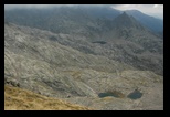
Twin lakes
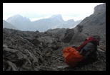


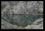
Lac de la
Lusière
(just above tent) |
Day 6:
Pagari-Pas de la Fous-Lac de la
Lusière
The day start up a bit foggy, but not too bad. I
have
decided to go through the Pagari pass (a short climb among rocks, the
Pagari glacier is just a memory at this time of the year) and to try to
reach the Pas de la Fous (Pas is another french word for Pass), if the
weather allows. Otherwise, if bad weather threatens, I would stop for
the day in Refuge de Nice.
The trip goes as expected, and I soon reach Pas de Pagari; from there,
the "twin lakes" are the next target (I have planned for a long time to
camp there, but this far did not get the timing right). The itinerary
is clearly marked in red on the Italian side, and is a pleasant path
(unfortunately absent on many french maps) on the french side, all the
way to Refuge de Nice. It is in principle possible to cut across
(around 2400m) to go directly to the Pas de la Fous without going down
the extra 300m to the Refuge. However, the weather is becoming quite
cloudy again, and I opt for the safety of a (possibly extended) stop at
the refuge. A lonely chamois keeps me company for a while, but an
incredible noise is coming from below. When I reach the refuge, I
realize not only that it is being completely rebuilt, but also that not
even a safety room is left available. The choice is made for me, and
since despite the clouds, the mountain passes are still clear, I haste
to the Pas de la Fous (marked -illegally- in white, but not in a very
reliable way). Under way, I keep a keen eye for possible retreats and
places to put my tent.
The path grows more stony, and soon becomes an ascent in more scree
(stable this time). We are back in a gray and black universe. (the
stones here are markedly darker, at least at the approach of the pass).
At one point it becomes clear that the safe way is to cross the pass,
and go down to the La Lusière lake, not much below, which I
know
from 2004.
The visibility is still acceptable when I reach the pass (2828m), but
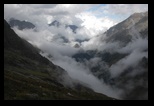
fog is streaming by, dramatically changing the view (see pictures,
taken at a few minutes interval).
The descent to Lac de la Lusière is in stable stones, the
marking (in red or orange) has is a bit sparse. At Lac de la
Lusière, I know of 3 small spots to put a tent. One seems to
have been
excavated a bit, and I choose to use it. It is flatter, but more in the
way of runoff water.
I settle below the overflow of La Lusière to the lower "Lacs
Gelés" (litterally: frozen lakes,
although not at this time of the year. The stream is minimal, but with
some effort I can fill my cooking dish. (it will change dramatically
over the night). I rest , eat and prepare for the night (in particular,
a provision of safe - filtered or boiled - water: this is usually my
first action when setting camp.)
Around 4pm, the rain starts...
|
|
 |
7th day :
Rest (or Rain
)
How
appropriate!
Indeed, the rain does not stop -- and will not stop for about 40hours !
When I say continuous rain, it has to be taken litterally: not one
minute of pause where one could escape to check the tent, or whatever
other task without getting wet for sure. In those conditions, staying
dry is critical, in particular at this altitude (we are still pretty
close to the pass, and way above the Lacs gelés).
Unfortunately,
the few "flat"spaces here are also subject to water runoff, and to some
accumulation. I realise water has accumulated between my ground sheet
(a protection plastic sheet below the tent) and the tent itself. As a
precaution, I pull this sheet away, hoping that the water will
pernetrate into the ground. It works to some extend, but when the rain
increases, accumulation again occurs. Is it some small seepage (the
bottom of the tent is really a waterproof tub, but pressure under the
mattress could defeat that), or condensation? I get some humidity
between the thermarest and bottom of the tent. Easy to fix, just move a
bit, and sponge away with my "camping towell" (a cheap, less than 1
€
duster in "non-tissé" cloth bought on some open market, just
as
efficient as brand name items). Then wait..
Just for the wait, and for contrast, I put here a picture taken in 2005
showing the Lacs Gelés and Lacs de la Lusière.
With some
magnification, an investigative reader will find where I put my tent!
(for info, the other possible sites were also flooded, although one
more exposed site just above was less so)
It gets pretty stormy, (it was also the first night), and the
situtation close to a pass favors upcoming winds, which shake the tent.
I am used to this, and know that the Hilleberg tent makes a lot of
noise (due to the thin but hard cloth), but withstands impressive
conditions.
Meanwhile, the meager stream has swelled, and becomes a roaring
waterfall (it is far enough, and the ground is steep enough that I am
in no danger from it.)
Precisely in the middle of the night, (watch says 0:00) I feel that the
back of the tent slumps...it only takes a minute to react. I just put
my jacket and nothing else (except LED lamp) to check... Well, it is
the already damaged pole which gave way. It is only a matter of seconds
to reach the repair kit, put the aluminium sleeve over the damaged
area, and I am safe again. Just hope the other weak spots of the other
day will hold better. After that, all is safe until the morning, but I
promise myself to get up at the first lights, pack (wet or dry) and
move down to the Valmasque lakes and refuge, which are probably less
than one hour away.
|
|
Valmasque
under the sun,
but I turn back..
Horizontally,
you reach
the pass..
(picture below)
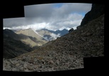
Col de
l4Agnel , seen
from
Lac Blanc
(Italian side)

Looking
back, from the
path to Pagari
 |
Day 8: From La
Lusière to Entracque,
by the Agnel Lake and Pass.
I do as I promised myself,
and pack
everything, under continuing but lighter rain, around 7 am.
When I am fully done, (with many precautions to avoid getting wet), I
start to go around the lake, and down the easy, clearly established
path (but not present on french maps) to the Valmasque valley. At this
moment, the rain stops, and gives a spectacular lighting on the Refuge
de Valmasque. I have already gone down about 15 minutes on the path.
Well, the Col du Lac de l'Agnel has frustrated me too much. (and I
don't want to exit again through Casterino), so I don't resist the
temptation, and turn back, climb to La Lusière again,
heading to the Chamassière pass (a short climb from La
Lusière, which brings me way above the Lacs
Gelés, with a
view to the Lac de l'Agnel -- I should say the lakes, as there is a
small lake clearly separated from the main one -- actually I precisely
camped between the two in 2005.
The picture here only shows the smaller lake, and a very small part of
the larger (more pictures when I write up the 2005 trip), but shows
clearly the scree under the pass.
From the pass, there are 2 ways (both marked by cairns). One leads down
to the land bridge between the lakes; the other stay approximately
level, and goes around the whole circus to Col du lac de l'Agnel,
visible close to the center of the picture. This time, I choose the
latter path
(I used the first in 2003).
The itinerary (rather than path: this is just a marked itinerary in
heaps of stones!) is quite easy, maybe the more touchy parts are a
(very) few steps on (slippery) grass, and leads to the rather broad
pass.
Getting down from the pass is through quite big
blocs. The
itinerary (now marked in red) avoids a number of rocky ledges, (you can
guess the way from the picture taken at Lac Blanc). It actually
branches at some height above the lake (I saw no special indication,
but as indicated by Alladar in Rifugio Pagari, there are two sets of
marks: one goes on at approximatively the same height, avoiding to go
down to the lake, which the other precisely does). At this time of the
year, there is no snow or ice in the way, and for the view I preferred
to walk down to the lake. The scree is a bit unstable here, but it is
mostly small stones sliding a bit, and not really dangerous. It is
possible to go around the lake (although this is tricky at times, and
one may need to climb slightly at times), and to reach its end. There
two big stones frame a path (again marked in red, I has lost the marks
for a while). This path actually climbs a little to meet the main path
from Pagari to Entracque, after crossing a couple of torrents. Actually
the torrents were quite impressive after the continuous rain,
and
it took some searching to find how to cross while keeping feet dry. (of
course, I still had the option of sandal crossings, swedish-style, but
I could avoid it). Actually, even on the main path the Entracque, a
number of streams (including the stream from Pagari, which I found dry
a couple of days ago) are overflowing, and take some ingeniosity to
cross. The two path means (with directional signs!!) shorlty before
meeting the main one.
On the way down, I turn back for a few pictures, stop to cook a meal (I
just took dry food and water for breakfast -- fortunately I had
prepared a good stock of purified water!). The rain threatens, starts
and stops. Clouds linger. Very wet chamois are very abundant around the
infinitely winding path!
Finally, I reach the bottom of this valley, and a dirt road which leads
to San Giacomo. There I hope to find a restaurant or a camp ground,
where I could ordre a taxi to Entracque if no public buses are
available (it turns out they stopped about a week before). But
everything is closed, except the camping, where no one is present and
the managers "will be back shortly".
I was half prepared to this, and set on my way on the tarmac road to
Entracque. A bit unpleasant with heavy mountain boots on the hard road,
the more so that the rain becomes really nasty. No pity from the 3 cars
or trucks encountered on the 10 km road (I must look too wet for their
seats!)
I am a bit concerned that any hotels in Entracque would also have
closed for the season (forgot to ask!), but when I arrive around 5:30
pm, it turns out that the tourism office is still open
(litterally every day in the morning and from 4 to 7 pm!), the lady in
charge is very helpfull, and I don't regret choosing this way rather
than the more usual Casterino exit (with the same problem of lack of
transportation).
Hotels are no problem (I stayed for 2nights in hotel "trois
étoiles" before it closed, and moved for one night to
"miramonti") (and people are very friendly, even though I am about the
last tourist around), but restaurants are more scarce, as most have
closed for the season. A cheap and very good pizzeria, and the
restaurant of Hotel Pagari (with a simple but savoury menu, featuring
chamois stew...)
|
|
|
|
|
