we avoided "pop-up" windows to leave
the reader a choice, and to avoid problems with protection softwares.
When clicking on images in
this page, you get a larger version in an image viewer, BUT in the same
window -- it is easy to use the browser facilities to open
the link in another tab or window (right- or centre-click,
depending on
your browser type) --
|
|
July
24th Abisko to Abiskojaure
We get
under way around 14h30, with reasonably dry weather, on the easy
Kungsleden path to Abiskojaure. The park is one of the very few places
in Sweden where camping is stricktly regulated, and almost no
possibility exists before the hut, except for a (very nice) site,
nicely set up on the path, but much too close for us from the
departure. Another camp site is posted, but involves taking a side path
leading effectively out of the park. By far the best choice for those
keeping on the Kungsleden would be to pass the hut, and camp further
south on the Kungsleden, just outside of the park (we saw those nice
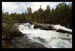
spots during our 2005 trip). The river is spectacular. At times, the
track is damaged by overuse, or by the passage of all-terrain vehicles.
We try to keep a good pace, as we must cross the park before setting
camp, and the weather seems to deteriorate. We reach Abiskojaure before
the rain, and set camp. The site is far from being our favorite. There
is some grassy patch for tents (but much too small to meet the demand
with reasonable spacing); we camp instead close to the wood pile. The
day cabin is carefully provided with mosquito nets...which prove very
much needed.
|
 |
July 25th On the way to
Unna Allakas
As planned, we avoid the Kungsleden,
and move along a more westerly path (roughly parallel) in the direction
of Unna Allakas and the Norwegian border.
The ground is very wet, and the atmosphere extremely humid. Mosquitos
abound in the wooded area (relatively dense birch forest). In many
places, the path is covered in water, and soggy everywhere else.
The ground is somewhat irregular, and passing on the top of some
morraines gives a little breeze.
We emerge from the woods to meet a Sami village, and continue on the
trail, which is now partly boggy, partly marked with 4X4 tracks. As the
weather further deteriorates, we find a camping spot (not too wet) next
to the (widened ) river bank, and make camp at 16h, just in time to
grab something to eat before the rain. Mosquitos are VERY present! Rain
in the evening and the first part of the night.
|
|
July 26th Unna Allakas.
The rain has stopped, and we only
need to deal with the (considerable) condensation before folding the
tent. A damaged bridge give a choice between planks split at an awkward
angle and a sandals crossing. Fortunately, we are on pretty level
ground, and despite the very wet conditions, this stream is quite
negligeable. We are now on higher ground, the path is drier and good,
mosquitoes less of a problem.
The weather deteriorates fast, and threatening clouds combine with a
very low ceiling, some mist settles.
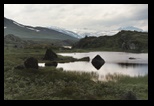
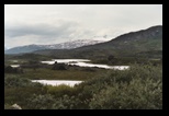
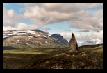
Big square black boulders emerge in the valley, between lakes and
moors, some fairly spectacular stones.
A little before Unna Allakas, we meet a rather large river (the direct
path to the North also joins at this moment). Sandals crossing...don't
put back the shoes too fast, as there is a second branch of the river
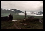
closeby. We reach Unna Allakas with the first drops of rain. The clouds
are very low, and fog lingers in-between.
We choose to stay in the hut, and take the occasion to buy and try some
"fruit soppa", some syrupy fruit concoction which is reconstituted from
dried powder-- an interesting addition to our diet!
Here, we also hear that the route coming straight from the north has
been blocked for several days, due to too high water at two critical
fords.
|
|
July 27th To
Norway
Showers in the morning, and a bad forecast. We get under way, with the
purpose of reaching the very close (about 7 km) Norwegian hut.
This is again fairly wet moors. The marking starts to be more typically
Norwegian: a completely different philosophy, much closer to the
cairns-marked paths in higher altitudes in the Alps. Here you have
markers when needed, (often stone piles, - the familiar cairns
-), but used rather sparingly. It is much nicer to the view (I
don't like to see a scenery dotted with red paint, like a trail marked
on a map!), but requires attention, and possibly backtracking if a
marker is missed. We will comment later on Norwegian bridges.
Before the hut, a new ford to cross (it is also possible to make a
rather long detour to a bridge, it seems). We cross where the river is
shallow, the current is there, but not too much pressure. A bit
impressive but safe. (a little downstream, the river becomes much
slower, but also much deeper before entering the lake).
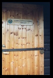
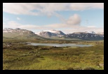
We reach the Cunojavri hut, (picture), which is duly locked with
a solid
padlock. It takes a little playing with the key to get it to open (we
were warned that the locks don't always operate very smoothly), but we
access a beautiful wooden cabin, where we warm up by a wooden fire.
Note that, despite the need of the key, the Norwegian cabins are
un-manned. Payment is done on the basis of a credit-card slip to fill
and leave in the hut. The price is also lower than in Sweden (less than
1/3 when we were there).
For
details about the huts in the Narvik area, and routes between them,
see http://www.narvikfjell.no
-- there is a link to pages in English, although a detailed
description of the routes was only available in Norwegian, at the time
of writing.
There are actually 2 independent huts in Cunojavri, and in the evening
we receive the visit of another trekker, who stays in the other. There
is even a boat available for venturing (or fishing ) on the lake - see
the above link for details about use and fishing rights.
This hut seems to be a favorite destination (despite the dense
mosquitoes), and in better weather can be quite crowded on week-ends.
We also learnt (through a museum in Narvik) that the path just
travelled was used during
WorldWar II as part of an escape route to neutral Sweden. However,
because this hut was at a time turned into a trap by the
occupants, it was
ultimately burnt by the resistance forces.
|

|
July 28th
The weather is dryer, and
improving. Soon we have sun, and a crystal-clear, crisp atmosphere.
There is a choice now facing us: two routes are possible. The most
natural crosses to the other side of the lake (there is a bridge), but
later involves some rather long fording on the other shore. We learnt
later that these fords, while wide, were in fact practicable, but for
the moment, and with the high water situation, we prefer to play it
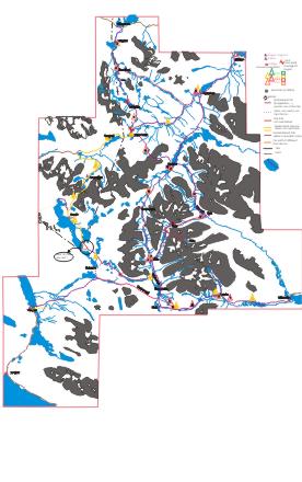
safe, even if it involves a long detour (see map).
The scenery is striking, at least for the first part. The "detour"
part, with a short stretch on a (deserted) service road for the dams,
is however a it long.
After this detour, we come back to our itinerary, follow the path to a
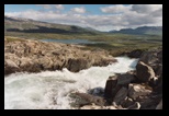
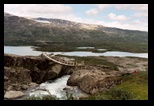
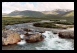
very spectacular river (it is not very wide, but rushes fast in a steep
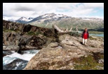
fall, and creates a cloud of steam in the otherwise green scenery).The
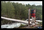
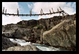
bridge is a typical example of the Norwegian ones: basically sound,
with strong steel cables, but with much less sturdy superstructure.
(don't always trust the handrails -- in the present one, the last
stanchion, while in place, was broken and would give way if leaned
against -- it is probably fixed now, but we
intentionally left it in the down position to make sure others would
not rely on it). At the difference of the powerfull Swedish STF, the
path system here is maintained by volunteer organisations. I must say
it gives a more "natural" (less standardized or organized) touch to the
trip.
Past the bridge, we face another choice, with 2 paths leading to
CAIHNAVAGGI, through different mountain passes. We choose what looks
like the easiest (if not the shortest one), and which meets the direct
path from Cunojavri.
The path along the river (basically backtracking what we did on the
other side) is rather trying, as the path gets lost between marshland
and moraine-like structures, and one has to find a way at times through
brush vegetation (there are paths, which need to be found,
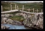
otherwise the progression can be quite difficult). We finally reach the
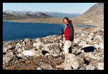
connection with the direct path, with another imaginative bridge, which
we do not need to cross. (picture below this text)
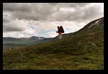
We turn into a new valley, the path ascends quickly, still on mostly
grassy land, and we decide to camp for the night, back on track at
approx. 800m height.
|
|
 |
|
July 29th
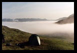
Nice weather! A low mist
fills the lower part of the valley, we are a little above (which
explains the overnight condensation), and enjoy a bright sun. We set on
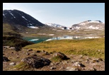
the way to CAIHNAVAGGI, which is further
up, and soon discover the high lake it borders.
At the hut, we meet two members of the Narvik trekking group which
maintains the hut system (see link above). They are doing volunteer
work, checking on the huts, on the accuracy (or lack of it) of the
paths descriptions on the maps. They provide us with plenty of
information, including a booklet (only in Norwegian), where the routes
are describe and ranked (the previous one was **, the next leg is ***),
and the different philosophy in trail marking. They also point out a
small variant (by the right instead of the left of the lake) that they
like to use when getting to the next pass.
We take a short break, eat some dried fruit, and get ready for the
following part.
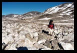
It starts with a ford (almost manageable with mountain shoes), then
some walk in fallen rocks (scree, or "pierrier" in French - stone field
would be an accurate description) on the lake shore.
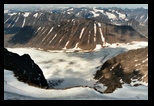
A panoramic view is given below
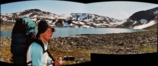
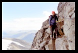
Probably the standard path can give a more gradual access to this path,
and avoid some scrambling in the rocks, which we had to resort to in
order to avoid steep snow patches.
The snow is replaced at times by big boulder fields, and here again, it
is a good idea to look for stone markers, which plot the least
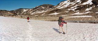
demanding path. The panorama before combines two pictures taken as
Kathleen was crossing one of the naeves, hence she appears twice!
(partly as a ghost)
|
|
July 30th
Sunny again, perfect occasion to air
the down sleeping bags, while we set up to Gautelis.
The path is rocky again at first, and it is wise to search the stone
markers to avoid the more tiring ground.
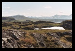
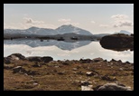
The view on the lakes is breathtaking.
We meet more vegetation as the path lowers to the Gautelis hut, where
we only make a brief stop (mosquitoes again, it is nice to be inside
for
a while to avoid them) .
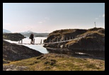
It is a very nice hut (cabin), actually a set of buildings with 2 main
huts, and according to the log book it has not been very crowded as of
late. There is also a small boat for trips on the lake! We head for
higher ground and set camp.
|
|
July 31st
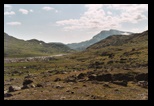
We move south, climb a little bit more, cross another interesting
bridge, and take the direction of Sweden. Here we get a small map
problem. At one point, the trail marks (sparse in any case, but we
don't mind) seem to disappear, at least along the path marked on the
(Swedish, December 2003) map.
See the sketch on our tour
map . The trail on the map (and the path we followed) goes down to
the end of a peninsula, at the end of the lake. Indeed there are some
old signs of a path there (probably related to an occasional boat
service on the lake), including a gate in a reindeer fence. But for
most of the time, we have to find our way, climbing back to the
plateau, and then we need to find a safe path to descend in the valley
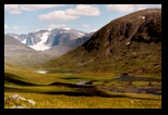
on the other side. Once on the Swedish side, we see a (shockingly)
bright line of large, shiny markers, which actually indicate to much
straighter path, through a pass branching higher on the trail.
(actually, from map and scenery, we had thought of trying that short
cut before settling for the map-suggested itinerary). We met some
trekkers coming the other way, and they confirmed that the map error
was mentioned in the Hukejaure hut (our itinerary veered East before
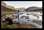
that hut, so we don't know more). We set camp close to a fast-running
stream.
|
|
August 1st
We reach the path moving East, where it will meet the Kungsleden
somewhat above Singi.
This is the main path marked on Swedish itineraries (while in 2003 we
took a nearly-parallel, less advertised itinerary). The impression is
quite mixed. The beginning of the path is very sound, easy and we move
fast, the scenery is beautiful, with plenty of water and sound ground.
It moves to a ford, wide but without major difficulties. After that
however, the path gets lost between boggy, "bumpy" areas, and the hill
side, which is equally difficult to travel. An unpleasant progression,
(the snowmobile trail alone is clearly marked, but impracticable in
summer), and we would certainly recommend the itinerary used in 2003
(just nearly parallel, and marked by a spaced dotted line on the
Swedish 1/100 000 map).
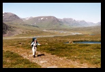
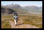
With one remark however: we have here a magnificent view on the
Kebnekaise mountain range!
We set camp close to the river, where there is a workable bridge, about
1 km away from Kungsleden
|

|
August 2nd
Still beautiful weather...
We move along the Kungseden. As before, we notice how damaged this path
is: overuse in the boggy areas has lead to severe erosion, -- then
people walk on the side of the path , causing more erosion, and ending
up in an area sometimes more than 10m wide, where the ground is
severely eroded, with just stones sticking out of the dried mud.
Actually, many of the less frequented or not marked paths turn out to
be more comfortable to walk. It is quite understandable from this that
planks are used at many sides, less to facilitate the walk than to
protect the environment.
We don't specially enjoy Singi, which is a major trail crossing,
and prefer to take the short cut through a small pass (quite a
bit higher) which leads more directly to
the Kebnekaise trail.
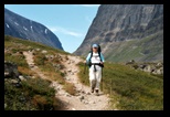
The view on the wide South-North valley hosting the
Kungsleden is striking , with the winding river
in stark contrast to the more rugged mountain paths.
We set camp on the other side of the hill, about hundred meters
above the path to Kebnekaise.
|

|
August 3rd
It is sunny, and we are
back on the path to Kebnekaise (a path we know from last year). It
starts with a narrow valley, some stones, which later widens on the
approach to Kebnekaise. This last part always seems long, as the goal
is in sight (the unmistakable carousel of helicopters landing at the
fjellstation), but several moraines and minor streams (sometimes with
bridges partly carried away by storms) need to be crossed. As
usual, the fjell station is in high demand (they even turn the saunas
into bedrooms at night ..), and very expensive, so we camp (some
distance above the station, rather than piling up with other tents just
close-by). And prepare for some well-deserved rest, after 11 days in
autonomy.
|
|
August 4th
Too quick a rest is probably not the best idea, and JM wanted for some
time to visit the top of Kebnekaise. There are in fact 2 main paths to
do this, one is without significant difficulties, but longer and
involves going down and up again at some stage, while the other, more
straightforward, crosses a glacier, and involves some rock scrambling.
This is the path used by the local guides, which lead groups on a
daily basis. Since Kathleen is not interested, I choose to join one of
these groups. It is fairly well organized, and, since the trip is long
(if not really hard), the guides start with a relatively quick pace: a
few people with insufficient endurance drop off in the first hour (this
is strongly encouraged by a generous refund policy, and avoids
difficulties later on). Still, the pace is not specially fast, not
enough to stop some continuous speakers (on some stretches, a few
percent increase in speed finally did the trick, to the general
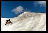
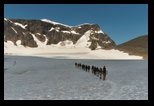
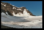
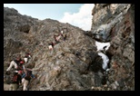
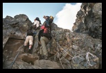
relief). I don't resist to put some pictures (although it is also part
of the standard advertising in Kebnekaise). After a long climb, we
cross some big boulders area (I prefer to use my sticks there, although
most people seem to avoid them, and place them well forward, on
different rocks; the carbide tip holds very well -- but I later
realized that Kathleen's poles had a much weaker tip, a thing we will
need to correct for next time). The glacier is really flat and easy to
crop; we use a rope for security, but with the soft snow, crampons are
not needed. After that, there is some scrambling up a rocky part,
fairly simple, and with "via ferrata"- like security (harness, and
fixed ropes, -- I hear they will soon be replaced by steel cables).
Unfortunately, the large group really slows down the ascent, and most
of the time is spent in waiting: this spoils a bit the pleasure of the
climb. We emerge in front of the "top-stugan", actually at the foot of
another scree (stone field), very stable and easy this time. After
that, the summit appears as the top of an ice pyramid (like you would
draw in a cartoon). Unfortunately, crampons were not foreseen, and we
climb on axe-cut steps, with the help of a rope.... I don't complain:
the view from the top is impressive, specially along the glaciers.
The way down proceeds by the same means, a bit slower at times, because
many seem tired. Some water
can be found in poodles below the glacier, but we mainly need to get
back to the valley to refresh properly.
|
|
Getting out
Here, we were lazy ... and curious!
Since we walked the exit path to Nikkaluokta once (and will have to
walk it in opposite direction in further trips), we decide to try the
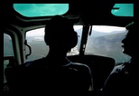
helicopter link. It is quite affordable, and we save a few days to
visit Narvik. On the way, we get a beautiful view of
the valley, and even of a bathing elk.
Narvik (which we reached by bus from Kiruna) is fairly expensive (by
belgian standards) for housing. It was the place of fierce battles
during WW II , of which it keeps a vivid memory (with a dedicated
museum). It is also the end of the railway, where the heavy ore wagons
unload into waiting boars.
There are some pre-historic prints to be seen, but they were not
accessible when we visited.
JM took the opportunity for bathing in a see we had not experienced yet
(the temperature being quite
manageable, in those relatively quiet waters at the very end of
a fjord). But clearly, to enjoy the place we would have needed
more time and planning, probably also a rented car, or at least some of
the boat trips to the Lofoten .
|
al
|
|
