|
Day 1 : Aug 15th : Entracque,
Trinita,
Vallone Bousset, Sabbione
We arrive in short after
noon in Entracque. The people in Hotel Miramonti are very nice, and
accept that we leave the car there (we hoped to return to the hotel
after the trek, but it proved impossible: we are earlier in the season,
it is very hot in the lower parts of Italy, and a large number of
people have chose to stay..). A taxi takes us to the start of the trek,
in Trinita and more precisely in Ponte Porcera (1083m).
It was very hot in Entracque, the air is somewhat more breathable here.
We start following the easy and wide path (car trafic is forbidden, but
the path is wide enough for cars in the first part). It is a very
pleasant area, quite luxuriant, with a strong alpine river rushing, and
for the first hour, good tree cover. As we wanted to get to a possible
campsite as soon as possible (the weather was hot, but rain and
thunderstorms are frequent in the afternoons), we did not take pictures
on the first part.
Some can be found in last year's page (see link here : Later:A teaser)
...
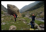
the first image on the left is actually extracted from there.
We reach the end of the wider track at Gias d'Ischietto, and the path
leaves the cover of the trees. From last year's reconnaissance JM was
expecting to find a proper bivouac site at Gias della Vallera (1517m),
but it turned out to be quite disappointing, with water difficult to
reach, and unwelcoming vegetation (large nettles and thistles, very
uneaven ground even in the empty pens used for the cattle). As the
weather becomes more threatening, we trust the map and climb to 1602m
where the path crossed the river (bridge) , and where it also branches
to cross the mountain chain in the direction of Palanfré.
(today's path is not on the map sketch
for lack of space)
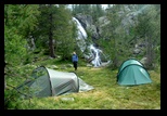
Just after crossing the bridge, we set camp along the river, just in
time to excape the first rain drops!
for
|

|
Day 2 Sabbione, Lago della Vacca
The next
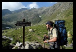
morning is a glorious day, and we get under way under the sun. It is
now a pleasant climb, we even cross a group of horse-back riders who
managed to come from the French side.
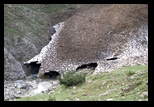
Very shortly above our camp site, we notice a left-over snow field
(neve), quite low in altitude indeed. Actually, despite the very sunny
summer, a harsh winter has left a number of traces (including, as we
will see, serious damage to the paths), and we will find again such
neves even lower on the French side.
Although another path exists on the other side of the river (East) , we
stay on the west part (left bank) and only cross the river again at
Gias della Culatta (1870). The sun is very strong now, but we get
partly in the shadow of the mountain for the next leg, which takes us
to Lago della Vacca.
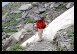
The path is still a mule-style path, but considerably narrower, and
damaged at some places.
A the top of this path, we cross the river to set camp along the lake.
This will also be our camp on the return, since it is precisely on the
path to the col del Veil del Bouc, which we can see from here.
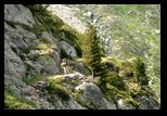
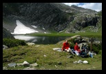
The place is both quiet and beautiful, a small neve melts into the
lake, and some young Ibex can be seen closeby.
|


|
Day 3
: Col del Sabbione, short cut
to Valmasque
Another bright morning, and we climb
above the lake della Vacca towards the Col del Sabbione.
After the col, we get to a wide scenery, with gentle grass slopes, and
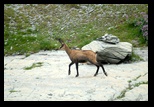
a large herd of mountain goats (chamoix) is idling around.
From below, we could see a path leading from Sabbione to Veil de Bouc,
but the crossing with our path is not visible ... a frequent occurence
as we will see, as the French park service seems to discourage people
from following any path they have not specially authorized. (this
includes a large number of paths perfectly visible on the ground, or
marked on maps ... just not on the French ones).
We follow the wide route , marked by large stones, this is the official
path leading to "Baisse de Peyrefigue" -- a very long way to reach the
Valmasque valley!
We choose instead to follow an older path, clearly marked on the
Italian maps, which cuts directly into the Valmasque valley following
the "Val du Sabion" on the French side (the name is similar, but it is
obviously not the same valley. This path will take us to
the the main Valmasque road at its branching to the Lac de
l'Agnel.
The path is actually not easy to find. Obviously, it is not marked, and
the grassy slopes don't show obvious marks -- and any track would
actually be confused with the mountain goats and cattle
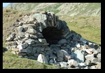
itineraries. The "lacs du Sabion" are just shallow depressions,
with uninviting water, but they run into a small river, and we find the
path on its banks. (the path is quite some distance
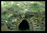
BEFORE reaching the dry stone structures shown here which
were used by the sheperds).
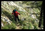
As we have experienced before, once the path is found, it is quite easy
to follow and actually well marked in the ground. A word of warning
however , as a short stretch is unprotected and on steep grass, which
could be very dangerous in wet conditions (we had no problem in the dry
weather). A bit later, the path climbs a few meters (just as it
passes a small ridge, under trees and fallen rocks). After that, it is
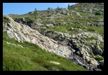
a winding descent to the Valmasque, and should be easy. Unfortunately,
the last part is completely damaged. It was winding in very short
legs on rocky terrain, but the carefully built switchbacks have been
demolished, either by wear, lack of maintenance, or intentionally;
and it is painstaking (specially with a heavy backpack) to get
down. The contrast with the nearby (maintained) path to the lake de
l'Agnel is striking. We cross a few French walkers, who remember the
path was much better marked. Once again, a path seems to fade at the
moment of crossing he "official" road. This is sad, since (as we
will see later) this path is a much more convenient link between France
and Italy than the long and boring itinerary through the Baisse de
Peyrefigue.... with all that advertising of a bi-national park with
European support!
We reach the Valmasque path (there is a good bridge) at the expected
point. We are in fact a bit surprised, since the itinerary up the
Valmasque has beeen changed. It used to be mostly on an old road, but
we hear that the stone bridges had been judged unsafe, and an alternate
footpath has been carved. This one also is eroding fast a places, but
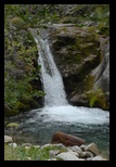
on the other hand it leads us to a waterfall which was previously out
of the way.
It is only early afternoon, but a thunderstorm is brewing. We set up a
temporary shelter (just the outer shell of the larger Nallo 3 tent).
After the thunderstorm, we decide to set camp here, just below the
steep part which leads to the Refuge de Valmasque.
|
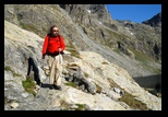
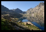
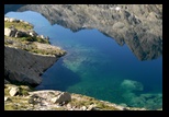
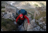
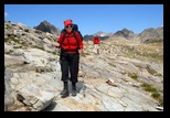
Baisse de Valmasque is the flat line ending the valley , seen here
above the lake. Baisse de Fontanalbe is to the left of the central peak.
|
Day 4
:
Baisse de Fontanalbe
Another bright
day; fortunately we stay in the shadow of the mountain to climb. The
path is one of te most-travelled, and climbs easily the steep morraine
before the Refuge de Valmasque. We don't go to the refuge, as it is a
detour, but follow the line of lakes,with the usual striking views.
-- -- --
Somewhat before the Baisse de Valmasque, which terminates the valley, a
path on the left (with an official marker, this time) leads to the
Baisse de Fontanalbe. Nothing difficult, but Kathleen prefers to give
up the walking sticks, as some parts are both rocky and narrow.
As usual, the scenery on top of the Baisse de Fontanalbe is something
striking, with very mineral surroundings. (see for instance 2004-5)
Before that, we have a panoramic views of the Valmasque valley, wihth
the Baisse de Valmasque to the left, and the Basto in front.
It is now an easy descent to
the Refuge de Fontanalbe (a small refuge
with a very warm welcome, good food, and an invariably "variable"
weather forecast). Before that, we enter the protected area with the
prehistoric stone carvings (for which Vallée des Merveilles is
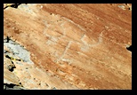
famous, but a very impressive set is to be seen here) . We just show 2
of them, the left is interpreted as 2 oxen (identified by their horns)
pulling a plow; the interpretation of the second one is less clear. It
has been suggested it is some skin being stretched to dry, ... there is
some strange resemblance to our own Hilleberg tent assembly
instructions (see day 6)
---- ---- ---- ---- ----
We set up our tent on the reserved aread (very nice , wooded grass
land, which used to be a stopover for cattle crossing the mountain) ,
just in time for the rain! Kathleen and Glenn decide to test the
refuge's dinner.
|


|
Day 5 : Lac Fontanalbe,
Peyrefigue, Col del Sabbione, Lago della Vacca.
Another hot day. We depart for a long walk, which will takes us down
from Fontanalbe to the heights of Casterino (back at the entrance of
Valmasque), and then back to the Italian side. For variety, we choose
to follow the "official" route. It is first a long, very gentle
downhill road to the trailhead...fully in the sun. From there,
still on a road (meant for mainly for off-road vehicles) we first
descend and then start the long climb to the Baisse de Peyrefigue. The
first part of the climb is somewhat in the shadows of a wooded area,
before we come in full sun again. The road is clearly signposted: it is
a favorite, since it leads to one of the highest access points to the
trails (2000m)
From there, it is a long, nearly
horizontal traverse (again in full sun, no water) to the Col del
Sabbione. Under way, we have quite a few views of the Valmasque area.
We reach back the gentle slopes below the Sabbione, near the dry stone
constructions. The water in the left-over lakes is unusable, even with
the best filter, we can get some from the stream mentioned before.
Instead of staying here overnight to continue tomorrow to the
Veil del Bouc from the Col del Sabbione, we decide to go down to our
previous bivouac (Lago della Vacca), where we will take the alternate
route.
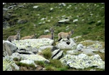
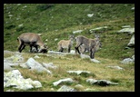
We also meet a number of Ibex (females and their young).
|


n


|
Day 6 : Lago della Vacca, Veil
del Bouc.
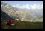
This is an alternate path to the Col
del Veil del Bouc, it is not fully marked (in particular in some grassy
parts, the path can get lost), but the terrain is quite easy and the
itinerary is easy to find.
This path meets the one coming from Sabbione before the final stretch
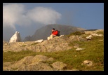
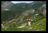
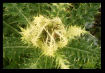
to the col (2620m). It is quite scenic, but in the same time flowers
abound. In the distance, the summits are playing in the mist.
-- - - -- -- --
-- --
-- -- -- -- --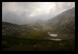 -- --
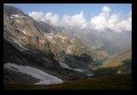
We have a panoramic view on the col
and on the Veil del Bouc valley.
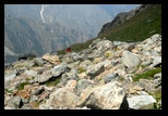
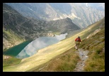
The first part of he descent is a bit steep (with a well-marked path in
gravel-like terrain), and later we are lead to some morraines. In the
distance, the path to the Lago del Veil del Bouc looks like a long,
gently sloping traverse.
We stop a few times on the road, notably to admire a young of young
male Ibex practicing their fighting. Quite a sight (and the hitting
horns resound around the mountain).
The path seeme easy from a distance, but is in fact barely marked: the
trail is obvious since the grass is missing, but the ground is sloping
strongly sideways, and in many places, the path has simply been taken
away by some sliding of he terrain over tens of meters, which makes the
progression quite tedious and tiring. Some expected streams are just
dry, or running under the rocks.
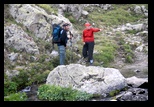
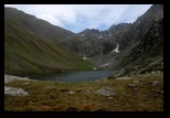
We finally make it to the lake (obviously a favorite picnic area for
day trips). We cross the river (there is some natural ford just at the
end of the lake, much safer than an old semblance of a bridge, below).
It is also used by the ubiquitous cows, who are tirelessly circling the
valley, night and day. (which causes some worry for our tent wires).
We set camp, before yet another thunderstorm, quite strong this time,
which leaves the dark summits clad in a sprinkle of snow.
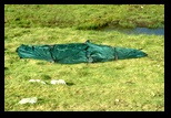
Note the pattern of our spread-out Nallo3 tent, for comparison with the
prehistoric rock engravings!
-- -- -- -- -- -- --
We experience a small problem with
our new filter (this time we took a stronger filter, the Katadyn VARIO
instead of the smaller Mini). This filter has a much more effcient
pumping system, which makes it much more convenient, if a bit heavier;
definitely for 3 people in a hot climate it is worth the weight. In
principle, it combines ceramic, fiberglass and carbon filters, the
first one, which can be easily scoured being optional. In our
experience, this first stage is essential; on the other hand, the
charcoal part is not really necessary here, and it is in principle
possible to remove it (which would save a bit of weight), while keeping
the fine fiberglass part in place. The trouble we had on this
last-but-one day was with the main axle of the filter breaking at the
tip, where it is supposed to lock in the frame. Fortunately, this did
not prevent the filter from functioning (just had to keep an eye on the
axle to make sure it stayed in place). We contacted Katadyn upon our
return, they seemed aware of the problem and sent us a stronger-looking
replacement part at no charge. Guess this was a teething problem of
this new filter (see equipment)
|

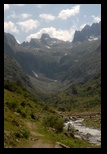 |
Day 7 : Veil del Bouc, San
Giacomo.
This is our last trekking day, (in
fact we are already one day beyond our initial estimate), and we are
reaching the bottom of our supplies (of course, with some emergency
foods, like nuts, left for safety). The path we take today is a very
classical one, much in use by day trippers. We are warned however that
it has been considerably degraded by the winter's storms. This is
clearly visible in a long descent through rough scree, where parts of
the path have been swept away, and an alternate is slowly building. It
is a long descent (in the end with magnificient views in the direction
of Pagari). We reach the lower valley close to the bridge leading to
the Pagari path, and continue to San Giacomo. Here also, storm damage
is evident. What used to be a good track for cars (at least off-road
ones) is at many places covered by rock slides. Closer to San Giacomo,
crews are busy freeing the road. Under he tree line, damage is obvious
with large areas felled by the storms.
In San Giacomo, we decide to order a taxi, back to Entracque.
As it turns out however, we will have trouble finding some place to
stay (see below: "after")
|
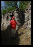

Valdieri
|
After the Trek :
In previous years,
we had no trouble finding a place to stay (even though we could not
predict exactly how long the trip would take). This time, we are
earlier in the season and our preferred hotel Miramonti is still full
(both the early season and the extreme heat in the Italian plains seem
to be playing this year!). While the Entracque tourist office had been
particularly helpful in the past (as mentioned in previous trip
reports), this time we got very little support, even obtaining a list
of hotels in the Cunea province proved impossible. By some luck, we
found back the card of a small hotel (noticed the previous years) in
Termi di Valdieri, Albergo
Turismo
just in front of the park office.
The owners (Roberto Parrone's family)
were very nice, provided simple but nice accomodatin and instead of
just one night, we stayed there to recover with simple but tasty
cooking in very quiet surroundings (in fact, an alternative would be
the nearby campside if the hotel proves full).
We cannot resist
posting a picture of the kitchen, with a large wooden stove still
providing part of the hot water for the hotel.
Most likely we will start our next trip from here, as it is an
excellent basis and one of the favorite access points.
We just could not resist a small trip around a "ghost village" above St
Anna di Valdieri (with an interpretative trail), but suffered really
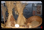
from the heat! On the way back, we watch local celebrations, including
a public lesson in rye bread making!
|


