When clicking on imagesin
this page,
you get a larger version in an image viewer, BUT in the same
window -- it may be preferable to use the browser facilities to open
the link in another window or tab (right- or centre-click, depending on
your browser type) |
|
Day 1:
July
28th
We chance it: after waiting in Kiruna, a small improvement in the
weather promts us to take the bus to Nikkoluokta (we arrive mid-day),
and from there to walk to the ferry which cuts a few kilometers off the
path to Kebnekaise. For the time being, we are lucky, and after a last
"RennBurger" at Lapp Donalds, we set up on our trip.
This path contains a number of "meditation sites" (usually in very nice
locations), which also provide good spots.
We settle for the night in a birch "forest" (the trees are rather
bushes), not far from the split of the track leading to Kebnekaise.
|

|
Day 2
The weather improvement is not there to last, but we walk to Kebnekaise
in time to get their nice buffet lunch, and leave in early afternoon.
Very soon, the weather deteriorates, and we are forced to set camp at
the end of the plain east of Kebnekaise, just before entering the
narrower passage between the mountains.
|

|
Day 3
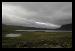
The weather barely improves, but a mixture of drizzle and calmer
moments allow us to make some way.
As usual now for us, we tale a
short-cut through the hills to avoid the Singhi area, but at the moment
of reaching the pass, the weather quickly deteriorates. The pass is
rather flat, with a couple of lakes, and our only resource is to
put a temporary shelter (the outer shell of the Nallo 3 is really
wide). After a while, we realize that no improvement is in view (but a
major chill if we don't take action), and we transfrom from the inside
this temporary shelter in an overnight one. It is no accident that we
settled close to water, as it is always a good strategy if one has to
wait for a long time.
|


|
Day 4
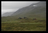
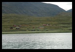
We wake up in the middle of a reindeer herd (we have seldom had them
this close), and despite the still unclement weather (at least it
stopped raining continuously) , we get under way to Sälka.
By the way, a new race (already called a classic) is taking the
Kungsleden itinerary from Nikkaluokta to Abisko, and we see the racers
(with orange tags) on the track...which starts looking like the
red-dotted Kungsleden on the Swedish maps!
We reach Sälka (of course, no way to stay in the huts, due to the
race), and set up camp on a plateau , near to the river. (JM
takes advantage of the very nice "bastu" (sauna), wood powered, with a
nearby suitably icy river )
Since there is a little shop, (and while the area is swamped with the
participants in the race, who have a food supply post here) , we buy
their last 2 pairs of woollen gloves: the weather is really cold, and
the demand has been high!
|


|
Day 5 :
Sälka to Nallo
We don't want to stay on
the Kungsleden (heavily travelled, and fairly deteriorated) and take a
side track to Nallo. The track is a bit difficult to find at first
(probably we missed the real start), but there are not so many places
it can be , and we reach it without difficulty. This track, south of
the main waters, crosses a number of (now dry ) small streams, but also
later a major ford. At this time, the ford was really easy,
(barely feasible without removing the shoes) , but we hear later at
Nallo that in high waters, a path north of the main streams/lakes is
better suited: however we did not try it.
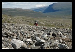
The scenery is both desolate (long stretches of flat stone fields,
barely interspaced by small rivers), until we reach the ford. This is
also the branching point for the Raita excursion, see tomorrow.
After that, the path runs on more grassy terrain, but some streams or
ice patches can be treacherous. In particular, a large snow patch leads
directly to the now very steep ravine where the river roars.
Rain threatens again as we reach the Nallo hut. We receive a very warm
welcome.
For this time , we decide to stay in the stuga, and settle for the
night.
|


|
Day 6 : Raita
The weather looks nice, but it seems some rest is called for.
JM sets alone for a day trip (with lighter gear) back to the
Raita area.
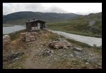
There is a very small (unguarded) hut, with just 2 bunks, and a
possible place to set a tent in these very stony surroundings.
The path has to be guesset at, but starts directly form the ford (walk
back there!), and perpendicular to the river, across long stone fields.
A line of cairns is present to the west (once the plateua has been
reached) but obviously other itineraries have been used.
After a very soft pass, one gets to the end of the valley, with the hut
(don't count on using it, there is strong competition, and little place
to put a tent!) and a spectacular view on a glacier and glacial lake.
From here, it is possible to join the tour around Kebnekaise by
climbing the glacier .. this is not considered for this day trip.
On the way back, a drizzle promptly degenerates to snow flakes, but
once back to Nallo, the weather gets calmer.
|


|
Day
7
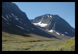
Finally a nice day, as we
set to the Vistavaggi, along a nice, rather green valley surrounded by
montains and glaciers.
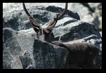
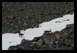
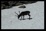
On the way, a few impressive reindeer
are seeking the cold on a snow patch.
For once, we set camp in the sun, somewhat before the bridge leading to
the Vista hut.
|
 |
Day 8
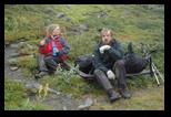
We wake up in a light rain, which
dissipates, but forces us to fold tents with the outside wet.
After crossing the bridge, we find the Vista hut closed (the warden is
visiting Nallo , we meet him later).
We hang the tent's second roof to dry.The way up the Vistavagge
starts in vegetation, then a rather marshy land. It crosses the river a
few kilometers up, and wanders through moors. Later it will move to
higher terrain, but once again, the rain catches up, and we have just
time to set camp again.
|


|
Day 9
Another greyish day,
rather cold with a chilly wind as we make our way up the Vista to
Allesjaure.
We cross a spectacular river with a nice waterfall, before climbing up
the plateau.
Later, we make it to Allesjaure, where we settle in one of the huts
after a detour to the "Tork room" (=drying room) (some wet
clothes start to feel heavy in the bag); a stop in
the "bastu" is also a must for JM, and this one is really
spectacular, perched on the hill.
The stugorna complex is large (one of the most important ones) and
itself perched high above the river (not far from a sami summer
village), and gets it water through water-driven pumps.
|


|
Day
10
The day starts dry (and will end dry, but with some serious rain
underway),
we decide to use the ferry service to skip the first few kilometers.
By the way, in the other direction, a sami hut with special radiophone
makes it possible to contact the ferry!
The rain looms over Norway to
the east of the montains, and finally crosses over and
blasts us for quite a while. It stops as we enter
the narrowing valley which leaves the large
lakes to our right and heads for Abiskojaure
and we get some nice weather.
It is forbidden to camp in the Abisko
reservation, so we hesitate at its entrance (this would be
a perfect camping site), but we choose for safety and set
up for the Abiskojaure huts, where we set our tents. Not the nicest
place, and when we arrive, the area is stinking from the burning waste
in the incinerator. At least, if needed, the common room offers some
shelter from the mosquitos, which are quite present here!
|


|
Day 11
It had to be like that...
we get a glorious sunshine for our last day on the trail
This is a path we
made in the other direction before. Still, the view of the river when
getting closer to Abisko is quite striking. We are even surprised at
the number of tourists on the rocks overseeing the gorges...but then,
it is just a sign we are close to Abisko!
Housing in Abisko is quite expensive, but we share a separate hut.
(cheaper than in the main hostel)
An impressive sunset over the hills gives us a last look... the next
day is rainy again!
|


|
After...
We get back by
bus the next day to Kiruna. Before flying back a couple of days later,
we visit a (much advertised) Sami village to the south. Besides the
usual reconstitution of huts (we saw some true ones around the
Paddjelanta), there is a small chapel with spectacular paintings.
|
